



7일킬리만자로 트레킹

7일 킬리만자로 등반, 레모쇼 루트
서쪽에서 외딴 열대우림을 지나 조용히 출발한 뒤, 시라 고원을 건너 남쪽 빙하와 정상으로 향합니다. 경치가 아름답고 고소 적응 시간도 넉넉한 루트입니다.
- 론도로시 게이트
- 시라
- 바랑코
- 바라푸
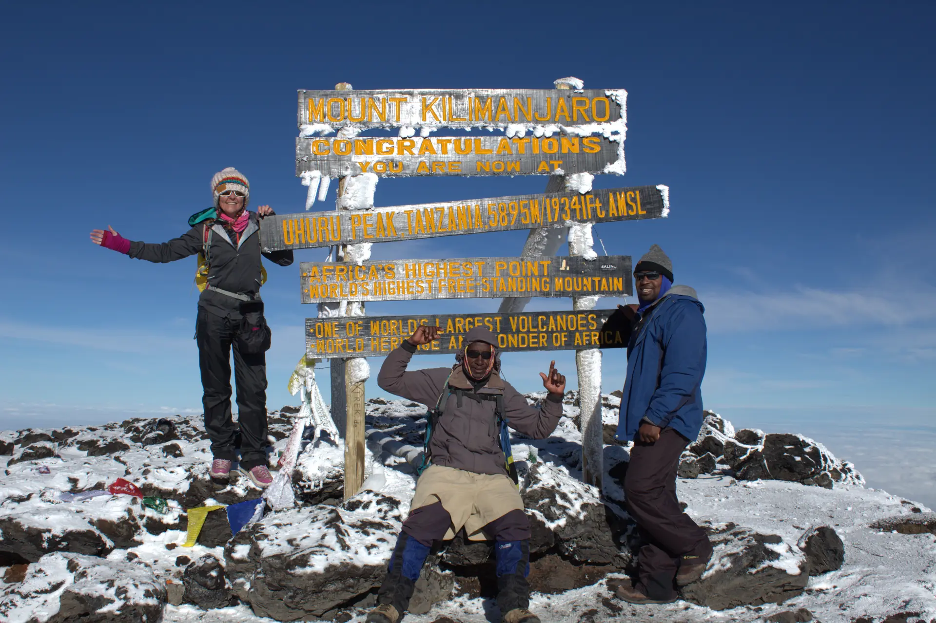
- 우후루 피크
개요
킬리만자로에서 가장 아름다운 루트 중 하나로 여겨집니다.
모든 일정은 맞춤 설정이 가능하며, 숙소는 저가형, 중급, 럭셔리 중에서 선택할 수 있습니다.
일정

1일차
론도로시 게이트에서 레모쇼 빅 트리 캠프로
론도로시 게이트에서 등록하고 농지를 지나 레모쇼 등산로 입구까지 차로 이동한 뒤 쉬운 숲길로 캠프까지 걷습니다.
2일차
시라 원 캠프
숲을 벗어나 거대한 히스가 자라는 황야로 들어서고, 시라 고원 가장자리까지 꾸준히 오른 뒤 고원 일부를 가로질러 캠프에 도착합니다.
3일차
라바 타워에서 그레이트 바랑코 계곡으로
오전에 올라 라바 타워 갈림길 근처에서 점심을 먹고, 절벽에 둘러싸인 그레이트 바랑코 계곡 바닥으로 내려갑니다.
4일차
바랑코 월에서 카랑가 캠프로
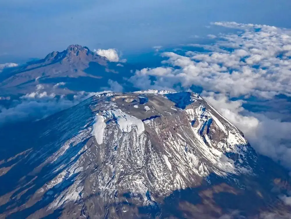
가파른 바랑코 월을 오른 뒤 키보 남동쪽 능선을 따라 남쪽 빙원을 바라보며 정상 전 마지막 물 보급지인 카랑가에 도착합니다.
5일차
카랑가에서 바라푸 캠프로
다져진 자갈길을 따라 바라푸에 도착하고, 4,800m까지 짧게 고도 적응 산책을 합니다. 정상 전에 일찍 쉽니다.
6일차
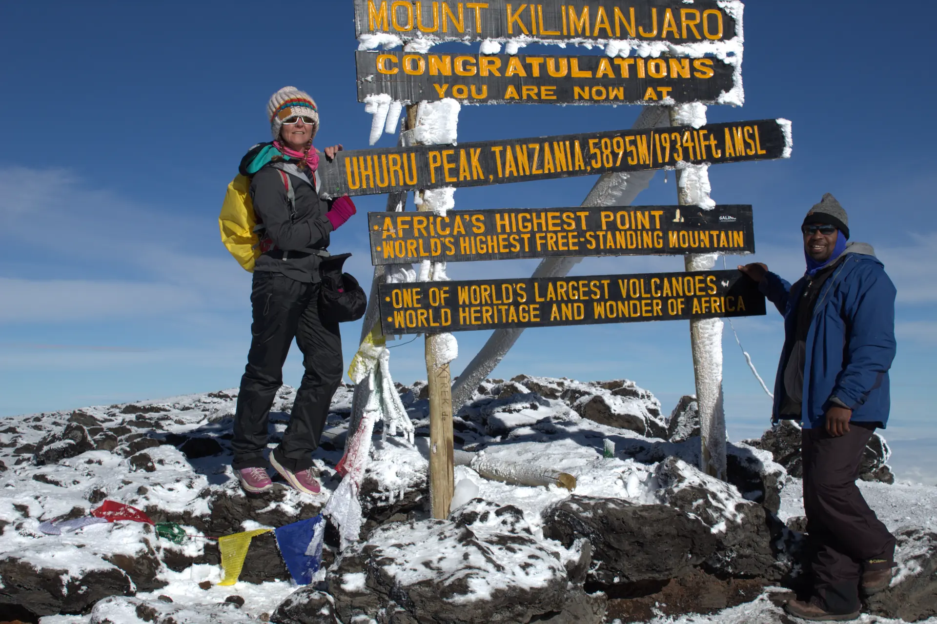
정상 등정일: 우후루 피크
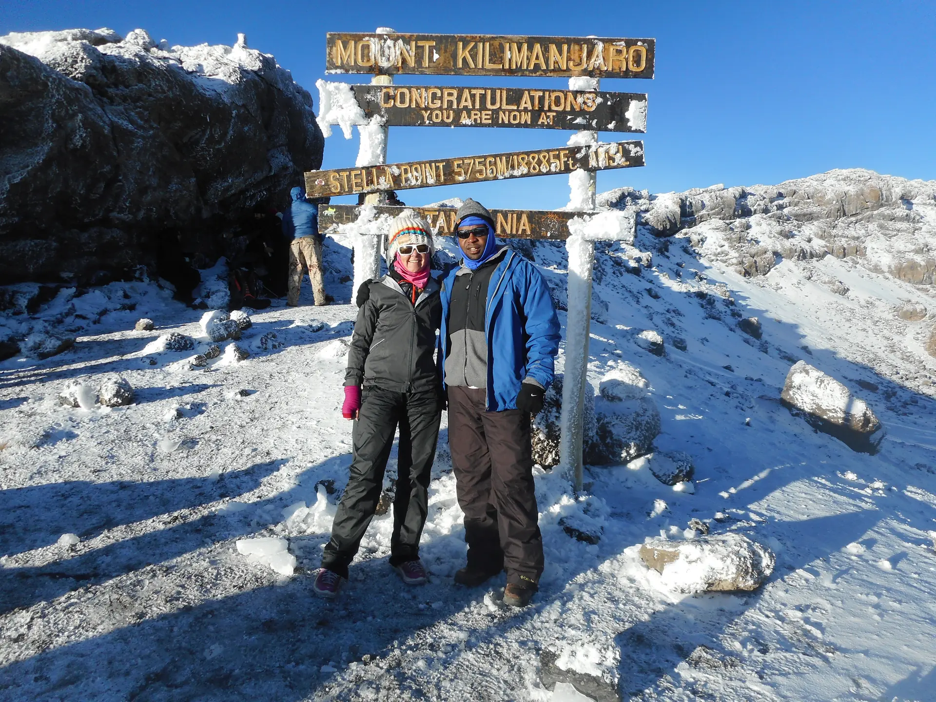
새벽 1시경 헤드랜턴을 켜고 출발해 일출 때 스텔라 포인트(5,735m)에 도착하고, 힘이 남으면 우후루 피크까지 갑니다. 밀레니엄 캠프로 하산합니다.
7일차
므웨카 게이트로 하산
숲을 지나는 긴 내리막으로 므웨카 게이트에 도착한 뒤 커피와 바나나 농장을 지나 므웨카 마을로 갑니다.
포함 및 불포함 사항은 서면 견적서에서 확인해 드립니다.
신뢰 및 회사 정보
- 사무실: P.O. Box 2071, Njiro Road, Arusha, Tanzania
파트너
- Tanzania Local Tour Operators (TLTO)
- Tanzania Association of Tour Operators (TATO)
- Tanzania Tourist Board (TTB)
- Tanzania National Parks (TANAPA)
- Kilimanjaro Search and Rescue
- Flying Doctors Society of Africa
- SafariBookings
- Kilimanjaro Review
자주 묻는 질문
등반 기술이 필요한가요?
아니요. 킬리만자로는 기술적인 등반이 아니라 트레킹이며, 특별한 장비나 등반 기술이 필요하지 않습니다. 다만 체력은 필요합니다.
몇 명이 정상에 오르나요?
7일 마차메 루트에서는 추가된 고소 적응일과 세심한 계획 덕분에 참가자의 95% 이상이 정상에 오릅니다. 더 짧은 루트에서는 성공률이 더 낮습니다.
보험이 필수인가요?
네. 등반에는 포괄적인 여행자 보험과 의료 보험이 필수입니다.
팁이 포함되어 있나요?
아니요. 가이드, 포터, 요리사에게 주는 팁은 관례이며 요금에 포함되어 있지 않습니다.
등반 후에 사파리나 잔지바르를 추가할 수 있나요?
네. 인기 있는 조합이며, 전체 여행을 저희가 계획해 드립니다. 사파리 + 킬리만자로 및 사파리 + 잔지바르 페이지를 참고하세요.
견적 요청하기
생각하시는 것을 알려 주시면 솔직한 조언과 맞춤 견적으로 답변드리겠습니다.
다른 일정
5일킬리만자로 트레킹
12일콤보 투어
4일야생동물 사파리
3일야생동물 사파리
6일야생동물 사파리
자세한 정보
이 내용은 영어로만 제공됩니다.

Climbing Program Summary
This is regarded as one of the prettiest route on Kilimanjaro. We begin trekking in the thick, fertile rainforest until we reach the wildflowers and shrubs of the heath ecosystem. Approaching from the west, we cross one of most beautiful areas on Kilimanjaro, the vast Shira Plateau, before traversing the mountain along the southern circuit. The Lemosho route is for those with previous backpacking experience.

Climbing Program Details by Day
Day 1: Registration at Londorossi Walking Through Farmland to Lemosho Big Tree C amp (2,650 m); [2-3 hours walking]
After completing the necessary registration formalities at Londorossi National Park gate, we drive through varied farmland with open views over the plains to reach the Lemosho road head. The last section of the road is of poor quality and difficult to drive after rain, sometimes we start walking a kilometer or two below the road head. We often have our lunch at the road head before starting to walk. It is an easy day of walking up a small path through beautiful and lush forest. We camp at Lemosho Big Tree C amp (2,650 m); [2-3 hours walking]
Day 2: Traversing Part of Shira Plateau to Shira One Camp (3,550 m) [6-8 hours walking]
We soon leave the forest behind and enter the moorland zone of giant heather. The trail climbs steadily with wide views to reach the rim of the Shira Plateau . There is a tangible sense of wilderness, especially if afternoon mists come in! We walk part way across the plateau to Shira One Camp (3,550 m) [6-8 hours walking]
Day 3: Trek Through Lava Tower Junction (4,550 m.) to Great Barranco valley (3,900 m); [7-9 hours walking]
A morning of sustained ascent and panoramic views brings us to lunch near the Lava Tower junction (4,550 m.). The trail then descends to the bottom of the Great Barranco valley (3,900 m); another spectacular campsite sheltered by towering cliffs and with extensive views of the plains far below. [7-9 hours walking]
Day 4: Trekking Through Barranco Wall to Karanga Campsite (4,000 m) [4-5 hours walking]
A steep climb up the Barranco Wall leads us to an undulating trail on the south-eastern flank of Kibo, with superb vistas of the Southern Icefields. The terrain changes to scree, with pockets of lush vegetation in sheltered hollows, and there is only a short distance to our camp at Karanga (4,000 m), the last water point on the way to the summit. [4-5 hours walking]
Day 5: Trek to Barafu campsite (4,600 m), South-East valley (4,800 m) [3-5 hours walking]
We follow an easy path on compacted scree with wide views that gains altitude unrelentingly to reach the Barafu campsite (4,600 m) for lunch. There is a short acclimatization walk to the plateau at the bottom of the South-East valley (4,800 m). The remainder of the day is spent resting in preparation for the final ascent before a very early night. [3-5 hours walking]
Day 6: Trek to Uhuru Peak (5,896 m) then descend to Millennium Camp (3,800 m). [10-15 hours walking]
We will start our ascent by torchlight at about 1 a.m. so that we can be up on the Crater rim by sunrise. The steep climb over loose volcanic scree has some well-graded zig-zags and a slow but steady pace will take us to Stella Point (5,735 m), in about five or six hours. We will rest there for a short time to enjoy the sunrise over Mawenzi. Those who are still feeling strong can make the two hour round trip from here along the crater rim to Uhuru Peak (5,896 m), passing close to the spectacular glaciers and ice cliffs that still occupy most of the summit area. The descent to Barafu is surprisingly fast, and after some refreshment, we continue to descend to reach Millennium Camp (3,800 m). [10-15 hours walking]
Day 7: Steady Descend to Mweka Gate (1,650 m) [4-6 hours walking]
A sustained descent through lovely forest with lush undergrowth takes us to the National Park gate at Mweka (1,650 m); and on through coffee and banana farms to Mweka village. [4-6 hours walking]